From WikiGallery

Jump to: navigation, search
Share:        Link to this page
Jump to: navigation, search

Map of Saint-Savinien on the Charente River in 1713 from Recueil des Plans de Saintonge

by Claude Masse

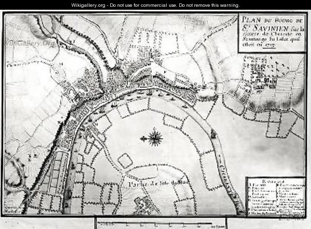
Map of Saint-Savinien on the Charente River in 1713 from Recueil des Plans de Saintonge - Claude Masse
[locked]

Information

Description
English: "Map of Saint-Savinien on the Charente River in 1713 from Recueil des Plans de Saintonge" oil on Canvas.
Source

http://www.wikigallery.org/

Author

Claude Masse

Download

Click here to download image

Permission

Free for non commercial use. See below. Click here to report copyright issues.

Like it

[locked]

Licensing

Public domain This image (or other media file) is in the public domain because its copyright has expired. However - you may not use this image for commercial purposes and you may not alter the image or remove the WikiGallery watermark.

This applies to the United States, Canada, the European Union and those countries with a copyright term of life of the author plus 70 years.


Note that a few countries have copyright terms longer than 70 years: Mexico has 100 years, Colombia has 80 years, and Guatemala and Samoa have 75 years. This image may not be in the public domain in these countries, which moreover do not implement the rule of the shorter term. Côte d'Ivoire has a general copyright term of 99 years and Honduras has 75 years, but they do implement that rule of the shorter term.


[locked]

Rate this Painting

NOT RATED YET
Click on the stars
to rate this painting


[locked]

Next Paintings

Map of Saintes capital of Saintonge from Recueil des Plans de Saintonge 1711 - Claude Masse
Map of Saintonge from Recueil des Plans de Saintonge - Claude Masse
Map of the town of Tonnay-Boutonne from Recueil des Plans de Saintonge - Claude Masse
Map of the towns and chateaux situated along the Charente River in 1714 from Recueil des Plans de Saintonge - Claude Masse
Plan of the Chapus Fort from Traite de Fortifications - Claude Masse
Plan of the Chateau de Forgette near Saint-Savinien from Recueil des Plans de Saintonge - Claude Masse
[locked]

Related Paintings

Crowded vessels off Venice by moonlight - Frank Wasley
A capriccio of a Mediterranean harbour with elegant figures disembarking, shipping beyond - Lorenzo A. Castro
The Wire-drawing Mill - Albrecht Durer
St Anthony preaching to the Fishes - Alessandro Magnasco
Fisherman - Richard Huttula
Talisman 1880s - Henryk Hector Siemiradzki
Rome, A View Of The Ponte Rotto - Jan Asselijn
The Ferry Boat - Frederick Richard Lee
A river landscape with fishermen drawing in a net - Jan Coelenbier