 |
This image (or other media file) is in the public domain because its copyright has expired. However - you may not use this image for commercial purposes and you may not alter the image or remove the WikiGallery watermark.
This applies to the United States, Canada, the European Union and those countries with a copyright term of life of the author plus 70 years.
 Note that a few countries have copyright terms longer than 70 years: Mexico has 100 years, Colombia has 80 years, and Guatemala and Samoa have 75 years. This image may not be in the public domain in these countries, which moreover do not implement the rule of the shorter term. Côte d'Ivoire has a general copyright term of 99 years and Honduras has 75 years, but they do implement that rule of the shorter term. Note that a few countries have copyright terms longer than 70 years: Mexico has 100 years, Colombia has 80 years, and Guatemala and Samoa have 75 years. This image may not be in the public domain in these countries, which moreover do not implement the rule of the shorter term. Côte d'Ivoire has a general copyright term of 99 years and Honduras has 75 years, but they do implement that rule of the shorter term.
|

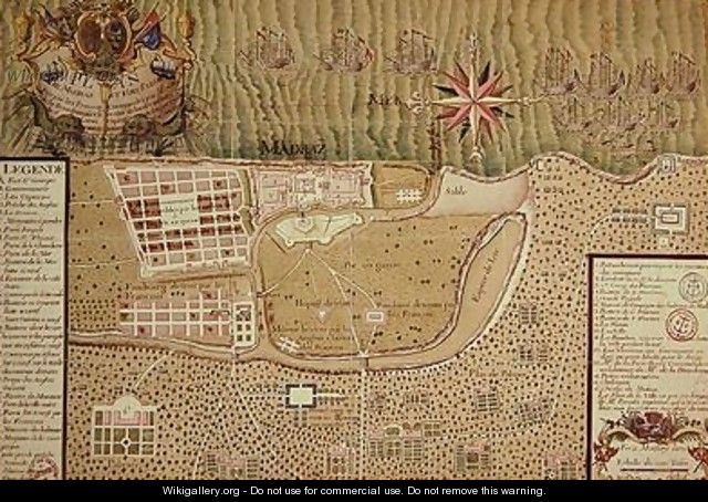
 Map of Madras at the time of the capture of the town and Fort of St George in 1746 by the French under the command of Mahe de la Bourdonnais 1750 - Maurille Antoine Moithey


