From WikiGallery

Jump to: navigation, search
Share:        Link to this page
Jump to: navigation, search

Map of Duisburg from Civitates Orbis Terrarum

by (after) Hoefnagel, Joris

Map of Duisburg from Civitates Orbis Terrarum - (after) Hoefnagel, Joris
[locked]

Information

Description
English: "Map of Duisburg from Civitates Orbis Terrarum" oil on Canvas.
Source

http://www.wikigallery.org/

Author

(after) Hoefnagel, Joris

Download

Click here to download image

Permission

Free for non commercial use. See below. Click here to report copyright issues.

Like it

[locked]

Licensing

Public domain This image (or other media file) is in the public domain because its copyright has expired. However - you may not use this image for commercial purposes and you may not alter the image or remove the WikiGallery watermark.

This applies to the United States, Canada, the European Union and those countries with a copyright term of life of the author plus 70 years.


Note that a few countries have copyright terms longer than 70 years: Mexico has 100 years, Colombia has 80 years, and Guatemala and Samoa have 75 years. This image may not be in the public domain in these countries, which moreover do not implement the rule of the shorter term. Côte d'Ivoire has a general copyright term of 99 years and Honduras has 75 years, but they do implement that rule of the shorter term.


[locked]

Rate this Painting

NOT RATED YET
Click on the stars
to rate this painting


[locked]

Next Paintings

Map of Edinburgh from Civitates Orbis Terrarum - (after) Hoefnagel, Joris
Map of Ekelenforde from Civitates Orbis Terrarum - (after) Hoefnagel, Joris
Map of Embden from Civitates Orbis Terrarum - (after) Hoefnagel, Joris
Map of Exeter from Civitates Orbis Terrarum - (after) Hoefnagel, Joris
Map of Flissinga from Civitates Orbis Terrarum - (after) Hoefnagel, Joris
Map of Forata and Jeresa from Civitates Orbis Terrarum - (after) Hoefnagel, Joris
Map of Frankenburg from Civitates Orbis Terrarum - (after) Hoefnagel, Joris
Map of Frankfurt from Civitates Orbis Terrarum - (after) Hoefnagel, Joris
Map of Gallipoli from Civitates Orbis Terrarum - (after) Hoefnagel, Joris
[locked]

Related Paintings

A View Of The Graslei Gent, With Many Figures On A Quay - Francois-Jean-Louis Boulanger
The Grand Canal with San Simeone Piccolo and Santa Lucia 1780s - Francesco Guardi
Map of the Magellan Straits - Guillaume Le Testu
View of Purrumbete Station looking North West Mt Leura and Mt Sugarloaf in the distance Australia - Eugene von Guerard
Dutch Ships Sailing In Rough Waters - Abraham Hulk Snr
A tranquil estuary - Arthur Douglas Peppercorn
A bustling harbour town - Ludwig Hermann
The other out at sea (illustrated) - Joseph Walter Of Bristol
Shipping Off The Dutch Coast - Abraham Hulk Snr
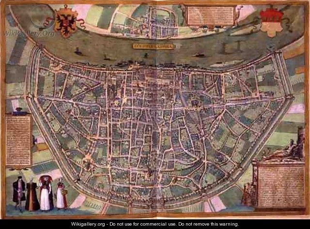